TOKOROA EARTHQUAKE DETECTION
This data is generated by an ONavi A 12-bit USB sensor and Quake Catcher Network QCNLive Software
The top line in Red is a relative likelihood of a real quake - Significance; the Z-Axis (Blue) is the Vertical Axis
for acceleration or movement, and the X and Y Axes are in the Earth's plane, Y being North
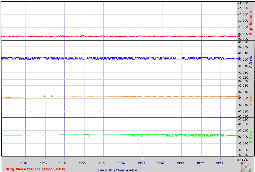
Note the data is reported in UTC which is 13 hours behind NZ. It is updated on the hour.
The sensor arrived with a cable and an introductory letter from the Quake Catcher Network of Stanford University.
A link for the Stanford University QCN Learning Center
The software QCNLive does not automatically create static images, or store data. It is only educational.
When on the QCN network, software "BOINC" will report a small file back if that software detects a shake has happened.


Click on the images above to go to the Quake Catcher Network site at Stanford University
Note I am using SnapShot software for the screen capture and the FTP function, AutoMacro software for the Keyboard
and mouse Macro action, and System Scheduler to force the operation every hour
This seismograph image is Copyright � 2007 - 2011 InmanAvenue.com. All rights reserved.
Owner: Graeme Sutherland, Tokoroa.

